|
3D
Nature has purchased all rights for this
training DVD and made it available for free download. This is
an extension of the tutorials included with Visual
Nature Studio 2 and
later versions. Produced by VNS consultant and instructor
Scott Cherba, these videos take you deep into the VNS world of
shapefile import, Search Queries, and Thematic Maps using
real-world data. You'll learn how to use VNS's advanced GIS
tools to create lakes, streams, roads, and Ecosystems with
shapefile vectors and attributes. The support files download
includes everything from the DVD: data for import, Components, projects, and HTML
versions of the tutorials compatible with the VNS Tutorial
Interface. The videos are also available on the world of a billion rabbit holes.
|
|
Before
You Begin
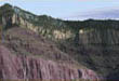
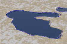
Part 1. Lakes
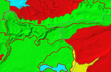
Interpreting metadata,
planning shapefile import, shapefile attributes,
shapefile import, sorting hydrographic features in
the database, organizing vectors in views, filling
Lakes with a multi-filter Search Query, filtering
out bad data, seasonal and permanent lakes, Thematic
Maps for Lake elevation, Effects memory management,
Search Queries for lakebed Area Terraffectors,
limitations of shapefile vector data, improving
vector resolution.
|
|
|
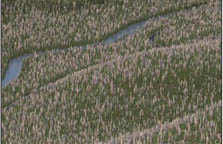
Part
2. Streams
Understanding metadata,
Strahler stream order, importing shapefile streams,
organizing streams in views, recognizing problems in
hydrographic data, creating a Strahler stream order
Terraffector, digging streambeds with a multi-filter
Search Query, recognizing and filtering out bad
data, intermittent and perennial streams, running
streams with Search Queries.
|
|
|
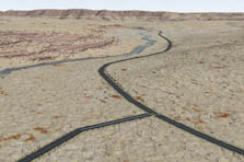
Part
3. Roads
Importing shapefile
highways, identifying problems with shapefile
vectors, improving shapefile vector render quality,
using Search Queries to place Terraffectors
according to road class, controlling Vertical
Displacement with a texture, identifying sources of
Effects memory errors and failure, what to do when
the memory well runs dry, working with Terraffector
Priority, recognizing limitations of highway
shapefile vectors, keeping warm with Terraffector
Freeze.
|
|
|
Part
4. Ecosystems
Using metadata to plan
Ecosystems, importing land cover shapefiles,
designing complex Ecosystems controlled by Search
Queries and Thematic Maps within Ecotypes,
organizing Ecosystems with Search Queries,
confirming Ecosystem Search Queries in views,
identifying Effects Resolution problems, building an
Ecosystem with one primary and several secondary
land covers, why you shouldn't directly control
Ecotype density with land cover percent attributes,
using Thematic Maps within Foliage Groups to turn
land cover percent attributes into Ecotype density,
using Thematic Maps to control secondary land cover
placement and density, building an Ecosystem with
multiple primary and secondary land covers, matching
an exposed rock Overstory to the Ground Effect.
|
|
|
Part
5. Marshes
When marshes are lakes,
but can't be Lakes; making marshes Ecosystems,
overlapping vector areas and Ecosystems, giving
marshes Priority.
|
|